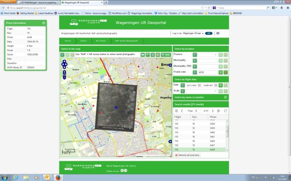
The site got stuck at the drop of a hat and visitors had to register first. That has now changed, and improvements to the website have made searching the collection genuinely user-friendly, says Joke Webbing of the Forum library. The more than 94,000 aerial photos taken by the RAF in the final years of the war are now easy to search through on the map or by postcode. The black & white photo you are looking for appears at the top of the screen exactly above the matching topographical map of the Netherlands. Staff at Alterra have already positioned more than 94,000 photos like this: a very fiddly job. One obtained, the photos can be downloaded. In low resolution (150 dpi), they are free. For higher resolution downloads (up to 1200 dpi) there is a charge. This service is run for the library by the company Dotka (www.dotka.com). Staff at Wageningen UR get a significant discount. The collection of aerial photos covers much of the country, with the exception of large areas of Brabant and the north. The improved site can be found at: http://library.wur.nl/WebQuery/geoportal/raf.
Improved site RAF aerial photos
Wageningen UR’s historic collection of aerial photos from World War II has been accessible online since last summer. But if you wanted a photo you needed a lot of patience.

