In Diepholz (Germany), some sixty thousand cranes are currently preparing for their autumn migration. Photo Shutterstock
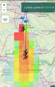
 With the autumn migration ahead, Koen de Koning (Environmental Sciences Group) launched a new version of “his” crane radar. The radar now displays a grid with colour codes showing the likelihood of a previously spotted group of cranes passing a specific location on the map in the next ten minutes.
The previous version already enabled one to estimate this likelihood somewhat from an oil spill-like spot on the map, which predicted the cranes’ likely path based on wind direction and speeds. A new algorithm, which includes, among other markers, the birds’ velocity, makes the predicted path much more accurate.
The improved version indicates the likelihood of the cranes passing your precise location through coloured pixels. The location is marked with a black dot (‘a more explicit marker would be nice’, says De Koning). If that location is within a transparent or light blue pixel, the chance of seeing cranes overhead is almost nil. In an orange or red pixel, there is a fair to large chance of spotting the birds. Keep your eyes and ears peeled.
Map layers
An additional new gadget is that visitors can now select different and multiple map overlays. For example, an overlay showing the direction of the wind and one showing the sightings from Waarneming.nl on which the radar is based.
With the autumn migration ready to begin -some sixty thousand cranes are currently preparing their migration in Diepholz (Germany), part of which may fly over the Netherlands – De Koning hopes many people will use the radar. ‘Although keeping it online during a wave of migration is always a little tense. We have now set the radar to update every three minutes rather than every minute so it can handle all the calculations. In the past, it would sometimes crash during the calculations and then restart without providing an update.’
De Koning verified last week that the improved radar works as intended when the first groups of cranes headed south over Limburg. ‘I contacted some ornithologists there through an app group. They confirmed what I saw on the radar: the birds were slow due to head-on wind. That interaction with people in the field was very useful and immediately provided me with new ideas for further improvements to the radar, for example, the link between wind velocity and flying behaviour.
Paper
A paper on the models that underpin the Crane Radar authored by De Koning was published this week. Anyone interested in testing the radar would do well to access it this coming Wednesday or Thursday when the next wave of migration is predicted based on the weather forecast. The migration will continue until mid-December.
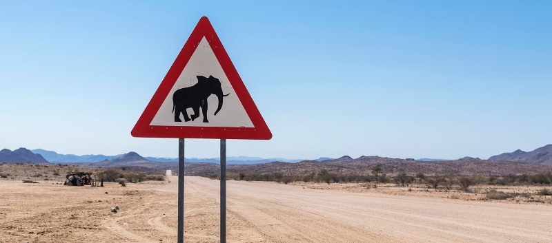
Bears, wolves and elephants
Although the carne radar has outgrown that stage, it started as a hobby project, De Koning says. ‘I have a passion for cranes, but I was always just a little too late or in the wrong place to see them. While the solution basically lies in correct mapping and better predictions. The Crane Radar is one of the first concrete applications of the digital twin technology in ecology. There are more ideas, however. We are currently investigating whether the radar is also useful for “problem bears” in Eastern Europe. If you know where the bears are active, you can calculate probabilities for problem areas so that inhabitants can take additional measures to protect their cattle. A similar approach may work for wolves. Outside of Europe we are investigating options for conflicts with elephants, in particular in Mozambique. I certainly see opportunities for a more extensive application in wildlife management.’